



Why Should We Pay Attention to Geo-AI Commercialization R&D?
The Ministry of Land, Infrastructure and Transport announced that it has completed the development of foundational technologies for Geo-AI, an artificial intelligence technology that understands and analyzes spatial information, and will begin research and development for commercialization starting in August. Since the AI analyzes spatial and temporal information together to display an answer on a map when a user asks a question in natural language, it has the potential to bring significant changes to both public services and private industries.
Until now, spatial information services often required users to manually zoom in on maps, select conditions, and interpret data. With the realization of Geo-AI, the service experience could change to one where users can ask questions in everyday language—such as "Where are the flood-risk areas near me?" or "Please show me areas that are close to train stations and have good access to parks"—and receive map-based results.
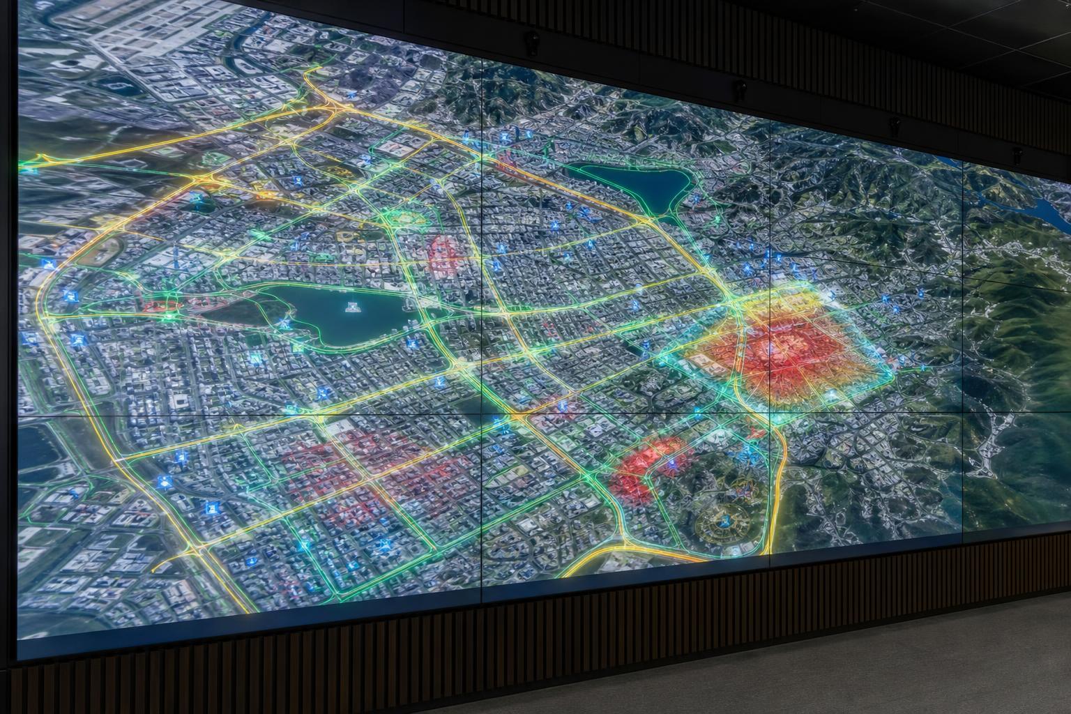
What is Geo-AI, and how is it different from existing map services?
Geo-AI is a concept combining Geo, meaning geographic information, and AI, meaning artificial intelligence. It refers to a technology that goes beyond simply displaying locations on a map; it enables AI to understand and analyze diverse spatial data—such as buildings, roads, land, population, traffic, disasters, and the environment—to generate answers tailored to the user's questions.
There are two key points. First, spatial AI must understand 'where' the data is located. Second, it must also analyze how the situation changes over time. For example, traffic volume, precipitation, changes in commercial areas, and development plans in a specific region all involve the conditions of location and time. Geo-AI focuses on interpreting this information integrally to provide answers in the form of maps.
Combination of text queries and map responses
Generative AI excels at understanding user questions in natural language and constructing responses. When combined with spatial information, the response method extends beyond simple sentences. After interpreting the user's question by categorizing it into conditions such as location, distance, administrative district, time, and risk, it can express the results as spatial outcomes in the form of map layers, routes, ranges, and points, lines, and surfaces.
For example, previously, to find "areas with a high incidence of traffic accidents around child protection zones in Seoul," one had to download multiple datasets and perform overlay analysis using GIS programs or map services. On the other hand, with Geo-AI-based services, the process of finding relevant data, interpreting conditions, and visualizing results on a map can be automated when a user inputs a question.
Representative data handled by Geo-AI
- Spatial data: lot number, road name address, building, road, railway, river, topography, administrative district, etc.
- Temporal data: changes in traffic volume, population movement, timing of disasters, development plan schedules, etc.
- Policy data: land use zones, urban planning, land use regulations, status of public facilities, etc.
- Living data: Public transportation accessibility, locations of hospitals, schools, and parks, commercial area information, etc.
- Risk data: Flooding, landslides, earthquakes, fire-vulnerable areas, heatwave-vulnerable areas, etc.
As such, Geo-AI handles data across the fields of mapping, administration, daily life, and safety. Therefore, while the technology itself is important, data accuracy, update frequency, and standardization levels significantly determine service quality.
Difference from existing search-based map services
| 구분 | Existing map services | Geo-AI based services |
|---|---|---|
| How to use | Users directly search for place names or addresses | User asks about conditions and purposes in natural language |
| Level of analysis | Centered on location verification, directions, and nearby search | Analysis by combining spatial, temporal, and policy data |
| Result type | Map display and list provided | Provides map, range, risk level, recommendations, and descriptive answers |
| Application field | Daily Movement and Place Exploration | Real estate, transportation, disasters, urban planning, administrative decision-making |
| Good luck | Information accessibility | Question-based problem solving and decision support |
In summary, Geo-AI signifies a transition from a 'service that displays maps' to a 'service that understands and answers questions on maps.' This is the primary reason why the Ministry of Land, Infrastructure and Transport's launch of this R&D project is attracting significant attention.
Why the Ministry of Land, Infrastructure and Transport and V-World Are Important
For Geo-AI to establish itself as a real-world service, simple AI models alone are insufficient. Reliable spatial data, public platforms, standardized data structures, stable APIs, and management systems for personal information and security are all required together. This is where the roles of the Ministry of Land, Infrastructure and Transport and V-World become crucial.
The significance of the spatial information policy promoted by the Ministry of Land, Infrastructure and Transport
The Ministry of Land, Infrastructure and Transport is a key ministry responsible for national spatial information policies and related infrastructure. Spatial information is foundational data directly connected to people's daily lives and industrial activities, such as roads, land, buildings, urban planning, and transportation networks. Therefore, for spatial information AI to expand into public services, data quality management and the establishment of policy directions at the Ministry level are crucial.
In particular, this R&D for Geo-AI commercialization is significant in that it is not merely a technical experiment, but a step toward advancing foundational technologies to the level of actual services. There is a significant difference between models operating in a laboratory and services used by the public. This is because realistic requirements, such as response speed, error handling, processing of large-scale users, reflection of the latest data, and the scope of legal liability, must be met.
What role can V-World play?
V-World is a representative government-provided spatial information platform that allows users to view and utilize various public spatial data on a map-based basis. In the future, if Geo-AI and V-World are combined, there is a possibility that users will be able to search for necessary spatial information in the form of questions, without having to navigate through complex menus one by one.
For example, if a user inputs, "Please show the land use regulations and surrounding development status of this area," the AI retrieves relevant data layers and presents them on the map in an interpretable format. Of course, the actual scope of implementation may vary depending on research and development results and policy decisions. However, platforms like V-World, which have accumulated public spatial information, can serve as an important foundation for the expansion of Geo-AI services.
Advantages of Public Platform-Based Geo-AI
- You can increase the reliability of your answers based on credible spatial information.
- It is easy to connect with national standard data such as administrative districts, lot numbers, and road names.
- It is advantageous for expanding into public-purpose services such as disaster management, transportation, and urban planning.
- It helps create an API and data ecosystem that private companies can utilize.
- It can support policy decision-making and citizen convenience services simultaneously.
However, public data is not always perfect. Data update cycles, differences in data formats across institutions, the handling of sensitive information, and the allocation of liability for analysis results are ongoing challenges that must be addressed. Therefore, the commercialization of Geo-AI requires not only AI model performance but also the maturity of data governance.
Expected use cases in real estate, transportation, and disaster response
The fields where the first tangible effects of Geo-AI will be felt once it is commercialized are real estate, transportation, disaster response, and urban administration. These sectors all share common characteristics: location data is crucial, various conditions must be assessed comprehensively, and understanding is enhanced when results are visualized on a map.
Changes in real estate information search
In the real estate sector, there is a significant demand to analyze location conditions and policy information alongside simply checking property prices. Users want to make informed decisions by comprehensively considering factors such as school districts, transportation, commercial areas, parks, hospitals, development plans, land use regulations, and flood history. However, currently, this information is scattered across various agencies and services, making it difficult for general users to conduct this analysis directly.
With the introduction of Geo-AI, it will become possible to ask questions such as, "Please show me areas with good public transportation accessibility and significant changes in commercial districts over the past five years." Additionally, we can expect a method that summarizes regulatory information, surrounding infrastructure, and past change trends for specific land or buildings on a single screen.
Transportation policies and mobility convenience improvement
In the transportation sector, congestion, public transportation blind spots, and pedestrian hazard areas can be analyzed based on real-time or cumulative data. For example, if a local government wants to identify residential areas with poor bus accessibility during rush hour, it must combine data on population distribution, bus stop locations, routes, dispatch intervals, and walking distances. Geo-AI can help perform such complex analyses more quickly and intuitively.
There is also potential for utilization from the perspective of individual users. Beyond simply finding the fastest route, it can evolve into route recommendations tailored to specific purposes and situations, such as "paths with a low risk of flooding during rain," "safer school routes for children," and "paths suitable for wheelchair access."
Disaster Response and Safety Management
Disaster response is the area where the public value of Geo-AI can be most clearly demonstrated. Flooding, landslides, wildfires, heatwaves, earthquakes, and fires are all strongly influenced by location and time. When a disaster occurs, it is necessary to quickly determine which areas are at risk, which populations are vulnerable, where shelters and hospitals are located, and what alternative routes are available if roads are closed.
When Geo-AI combines spatial information with real-time situational data, disaster managers can make faster decisions. For citizens, it can be utilized to provide risk information based on their current location or display nearby evacuation facilities on a map. However, since disaster information is directly related to life and safety, AI responses must be based on verifiable data and clear standards.
Efficiency in urban planning and administrative services
In the field of urban planning, it is necessary to comprehensively analyze changes in population structure, transportation networks, social infrastructure, the environment, and land use status. Geo-AI can assist administrators in quickly identifying necessary areas, comparing policy alternatives, and providing citizens with easy-to-understand map-based data.
| 분야 | Possible question examples | Benefit |
|---|---|---|
| real estate | Where are the areas that are near a subway station and have good access to a park? | Support for location analysis and comparison of living infrastructure |
| 교통 | Please show me the sections where congestion recurs during rush hour. | Support for route adjustments, road improvements, and traffic policy formulation |
| calamity | Please check low-lying areas at high risk of flooding during heavy rain. | Strengthening preventive measures, evacuation guidance, and emergency response |
| Smart city Planning | Where are the densely populated elderly areas lacking social infrastructure? | Support for public facility placement and regional balance policies |
| 환경 | Please analyze heatwave-vulnerable areas and areas lacking green space together. | Climate adaptation policies and support for urban environmental improvement |
As such, Geo-AI is not limited to a single specific field. It is closer to a platform-type technology that connects various policies and lifestyle services through the common foundation of space.
Key Challenges to Address for Commercialization and FAQ
For Geo-AI to truly become a trusted service among many users, it must meet several important conditions. It is not enough for the AI to simply generate plausible answers. Since the answers provided on the map can be linked to actual locations, legal information, and safety judgments, higher accuracy and explainability are required.
1. Data accuracy and timeliness
Even small errors in spatial information can have a significant impact. Incorrect address connections, delayed updates to road openings, or outdated disaster risk data can lead to erroneous judgments. Therefore, the first condition for the commercialization of Geo-AI is reliable source data and a continuous update system.
2. Presentation of the basis for the AI response
One of the weaknesses of generative AI is that it can produce answers that appear factual but are actually inaccurate. This issue is more sensitive in spatial AI. When a user asks, "Is this area safe?", the AI should not provide a definitive answer, but rather present the data and criteria used to make that judgment. For instance, reliability is enhanced when supporting evidence, such as flood risk, history of past damage, terrain elevation, and drainage facility information, is displayed.
3. Protection of Personal and Sensitive Information
Spatial information can be linked to an individual's living radius, movement patterns, and place of residence. In particular, when combined with data on transportation, disasters, welfare, and medical accessibility, there is a possibility that sensitive information may be revealed. Therefore, it is important to adhere to the principle of anonymizing information that can identify individuals and utilizing only the minimum amount of data necessary for the intended purpose.
4. Balance between public interest and private sector utilization
Geo-AI can enhance the convenience of public services while simultaneously providing new opportunities for the private sector. This is because spatial information AI can be utilized across various industries, including real estate tech, mobility, logistics, smart cities, insurance, and environmental consulting. However, it is also important to ensure accessibility and fairness so that public data does not operate in a way that favors only specific companies.
5. User-understandable interface
Even with excellent technology, widespread adoption is difficult if users find it challenging. Geo-AI services must be accessible not only to experts but also to the general public. Service satisfaction can be enhanced when features such as question examples, map layer explanations, result interpretation guides, and error reporting functions are provided.
FAQ
Q1. How is Geo-AI different from general generative AI?
While general generative AI primarily focuses on generating text, images, and code, Geo-AI is specialized in understanding and analyzing spatial data that includes location and time information. In other words, it differs in that it can express answers to questions not merely as sentences, but as locations, ranges, routes, and risk levels on a map.
Q2. When will Geo-AI, promoted by the Ministry of Land, Infrastructure and Transport, be available for use?
The Ministry of Land, Infrastructure and Transport announced that it has completed the development of foundational technologies and will commence research and development for commercialization starting in August. The timing of the actual public release of the service and specific functions will need to be confirmed based on future research and development results, pilot operations, and policy announcements.
Q3. How can V-World and Geo-AI be connected?
V-World is a platform that provides public spatial information based on maps. When Geo-AI is combined with V-World's spatial information, it becomes possible to offer a service where users can ask questions in natural language and view the analysis results of relevant public data directly on a map.
Q4. Can I trust Geo-AI results as they are when making real estate investment decisions?
Geo-AI can assist in the rapid analysis of information such as location, transportation, regulations, and living infrastructure. However, since real estate decisions involve a combination of various factors including market prices, legal rights, financial conditions, and personal circumstances, they should not be made solely based on AI results. It is advisable to verify official data and expert reviews together.
Q5. What is the most important point when Geo-AI is utilized in disaster response?
Accurate data, rapid updates, clear evidence, and coordination with field agencies are key to disaster response. Even if AI predicts hazardous areas or provides evacuation information, the final guidance must align with the official disaster response system, and verification procedures are required to reduce the possibility of errors.
Conclusion: AI that answers on maps, the next step for spatial information services
The Ministry of Land, Infrastructure and Transport's initiation of R&D for the commercialization of Geo-AI marks a significant turning point in the expansion of spatial information services from a focus on simple queries to question-based analysis services. The combination of public spatial information platforms like V-World, the natural language processing capabilities of generative AI, and highly reliable national spatial data can generate tangible benefits in various fields, including real estate, transportation, disaster response, and urban planning.
Of course, challenges remain before commercialization, such as data quality, personal information protection, providing the basis for AI responses, and service stability. In particular, spatial information AI applied to public services must ensure accountability and transparency alongside convenience. It is crucial that technological development and institutional reforms proceed in tandem so that users can make decisions based on reliable information.
As Geo-AI becomes part of our daily lives, it is highly likely that we will move beyond simply manipulating maps to find information, and instead have the experience of asking questions of maps and receiving contextual answers. If the public and private sectors utilize data safely and fairly, spatial information AI can establish itself as a foundational technology that simultaneously enhances the convenience of daily life and social safety.
AI Summary: Geo-AI is a spatial information AI technology that combines users' natural language queries with spatial and temporal data to provide answers in the form of maps. The Ministry of Land, Infrastructure and Transport's commercialization R&D can serve as an opportunity to advance services in real estate, transportation, disaster response, and urban planning by connecting public spatial information platforms such as V-World with generative AI. However, for this to become a sustainable service, reliable data, privacy protection, and the presentation of the basis for the answers must be established together.


