





Why the news of Geo-AI development completion is important
Interest in the digital transformation of smart cities and transportation is growing as the Ministry of Land, Infrastructure and Transport announced the completion of foundational technologies for 'Geo-AI,' an artificial intelligence technology that understands and analyzes spatial information. This technology is particularly significant because it goes beyond simply displaying maps and focuses on interpreting urban, transportation, disaster, and administrative data within a spatial context.
According to the announcement, the development results are scheduled to be pilot-tested on V-World, an open platform for spatial information, and will subsequently proceed to the R&D phase for commercialization. Users seeking reliable information need to carefully examine what Geo-AI is, where it can actually be applied, and what challenges remain before commercialization.
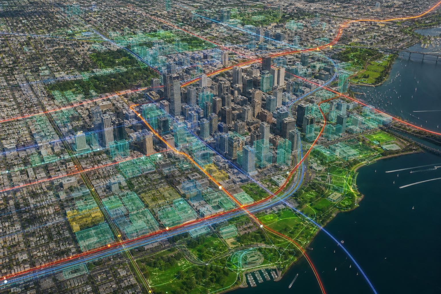
What is Geo-AI? Core Concepts of Spatial Information AI
Geo-AI is a concept that combines 'Geo,' meaning geography and space, with 'AI,' artificial intelligence. Simply put, it is a technology that enables AI to understand and analyze location-based data, such as maps, satellite imagery, aerial photographs, road networks, building information, administrative districts, traffic volume, and facility locations.
Existing spatial information services centered on users searching for desired locations or overlaying information onto maps. In contrast, spatial information AI is evolving in a direction that learns from vast location-based data to identify patterns, predict potential changes, and present results that can be utilized for policy or service decision-making.
Differences between General AI and Spatial Information AI
While general AI analyzes documents, images, audio, and numerical data, spatial AI considers both 'where the data is located' and 'what relationship it has with the surrounding environment.' For example, even with the same traffic volume, the interpretation varies depending on whether it is a residential area, a commercial area, near a school, or close to a transfer station.
| 구분 | General AI | Geo-AI, a spatial information AI |
|---|---|---|
| Key Data | Text, image, voice, table data | Maps, satellite imagery, coordinates, road networks, buildings, traffic data |
| Analysis criteria | Content, form, and pattern-centered | Considering location, distance, density, accessibility, and even the surrounding environment |
| Example of use | Document summarization, image classification, customer consultation | Urban planning, traffic optimization, disaster response, location analysis |
| Good luck | Business Automation and Prediction | Spatial Context-Based Policy and Service Decision-Making |
Why is Geo-AI getting attention now?
Smart cities, autonomous driving, digital twins, disaster safety, and carbon neutrality policies are all deeply connected to spatial information. Road congestion, pedestrian movement paths, flood-risk areas, accessibility to public facilities, and green space distribution all gain clear meaning when analyzed based on location.
- As cities become increasingly complex, the need for data-driven decision-making has grown.
- The amount of spatial data, such as satellite imagery, drones, sensors, CCTV, and transportation cards, has increased rapidly.
- As digital twin national territory and smart city projects expand, the demand for precise spatial analysis has increased.
- Advancements in AI technology have laid the foundation for rapidly processing and predicting large-scale spatial information.
Against this backdrop, the Ministry of Land, Infrastructure and Transport's completion of Geo-AI foundational technology development can be regarded as a turning point that expands the scope of public spatial information utilization. However, the completion of foundational technology development does not immediately imply the commercialization of all services; actual field application and quality verification processes are also required.
Ministry of Land, Infrastructure and Transport Geo-AI Development Achievements and V-World Application Plan
The core of Geo-AI, as stated by the Ministry of Land, Infrastructure and Transport, is the foundational technology that enables AI to understand and analyze spatial information. The key term here is 'foundational technology.' This is a broader concept than simply creating a single specific app; it is closer to meaning that a technological foundation has been established that can be commonly utilized across various services and industries in the future.
The significance of the pilot application in V-World
V-World is an open spatial information platform that makes domestic spatial information available for anyone to use. It provides various data, including maps, 3D spatial information, administrative districts, buildings, and land, which have been utilized by public institutions, companies, researchers, and developers to build spatial information services.
If Geo-AI technological achievements are pilot-tested on V-World, there is potential for the platform to evolve from a simple query-centric model into an intelligent platform equipped with analysis and prediction capabilities. For instance, it could become possible for AI to comprehensively analyze surrounding traffic conditions, development potential, facility accessibility, and risk factors when a user designates a specific area.
Elements that foundational technology development can include
While the specific technical configuration may vary depending on the scope of disclosure and subsequent research, the generally important elements in spatial information AI are as follows:
- Spatial Data Learning Techniques: It is a technology that organizes and converts map, coordinate, image, and facility data into a format that AI can learn from.
- Spatial Object Recognition: It is a function that identifies objects such as roads, buildings, green spaces, and rivers in satellite imagery or aerial photographs.
- Spatial Relationship Analysis: It calculates the distance between specific facilities and residential areas, road network connectivity, and accessibility to living areas.
- Change Detection: Identify how urban structure, land use, and traffic flow have changed over time.
- Predictive Modeling: It is used to predict traffic congestion, development demand, disaster risks, and population migration potential.
While these technologies may exist separately, the value of Geo-AI lies in connecting various spatial data within a single context to aid in practical decision-making. When combined with the public platform V-World, both data accessibility and usability can be enhanced.
Why Commercialization R&D Is Necessary
Just because AI technology has achieved results during the research phase does not mean it immediately becomes a stable service. Commercialization R&D is a process of verifying performance, speed, security, user experience, and cost structure so that the technology can be operated in an actual service environment.
- You must verify whether accuracy is maintained across various regions and data conditions.
- When public and private data are combined, it must be checked to ensure there are no personal information or security issues.
- It needs to be refined into a service format that local governments, businesses, and citizens can easily utilize.
- We need to establish criteria for how to incorporate the analysis results produced by AI into administrative decision-making.
Therefore, the next stage of commercialization R&D can be viewed as a key process that enhances technological maturity while simultaneously verifying its applicability to solving real-world social problems.
Areas where Geo-AI can change in smart cities
A smart city does not simply refer to a city equipped with a large number of sensors and platforms. It is closer to a method of urban operation that identifies problems through data, provides better services to citizens, and enhances administrative efficiency. Geo-AI can serve as a key tool supporting spatial decision-making in this process.
Urban Planning and Living Area Analysis
Urban planning is not simply the task of deciding how to divide land. It requires comprehensive consideration of population structure, transportation accessibility, the locations of schools and hospitals, the distribution of parks and cultural facilities, changes in commercial areas, and disaster risks. Geo-AI is well-suited for integrated analysis of these factors on a map.
- You can objectively compare candidate sites for new public facilities.
- You can find areas where the transportation-vulnerable or the elderly have difficulty accessing public services.
- You can visually check infrastructure disparities by living area and set priorities for improvement.
- Long-term urban planning can be supplemented by analyzing population changes and development demands together.
For example, when identifying a location for a new daycare center, one cannot simply look at the number of infants and toddlers. A rational decision requires considering pedestrian accessibility, road safety, the capacity of existing facilities, and residential density. Geo-AI can automate or assist in the analysis of these complex conditions.
Combination with digital twin
A digital twin is a technology that precisely replicates the real world in a virtual space. By reproducing roads, buildings, terrain, underground facilities, and traffic flow in a digital space, simulations can be conducted before actual construction or policy implementation.
When Geo-AI is combined with digital twins, it goes a step beyond simple 3D maps to create intelligent city models that predict future changes. For example, it allows us to preview how surrounding traffic volume will change when a new road is constructed, or how large-scale development will affect the demand for social infrastructure.
Disaster Safety and Environmental Management
Spatial AI can play a crucial role in disaster response. The risk of events such as flooding, landslides, heatwaves, fires, and ground subsidence varies significantly depending on specific locations and environmental conditions. By analyzing topography, drainage facilities, building density, population distribution, and past damage history together, more proactive responses become possible.
| 분야 | Geo-AI Application Potential | Benefit |
|---|---|---|
| Flood response | Low-lying areas, drainage networks, rainfall, analysis of past flood history | Prior identification of risk areas and supplementation of evacuation plans |
| Heatwave management | Analysis of green spaces, building density, and distribution of vulnerable populations | Determining priority for placement of heat shelters and installation of shade canopies |
| landslide prevention | Analysis of slope, geology, rainfall, and land use change | Strengthening monitoring of vulnerable areas and alert systems |
| urban environment | Analysis of green space accessibility, urban heat island, and air quality spatial patterns | Regionally Tailored Design of Environmental Policies |
Of course, it is appropriate to understand AI analysis not as a substitute for final judgment, but as an auxiliary tool that helps personnel make decisions more quickly and accurately. Particularly in the field of disaster safety, on-site verification, expert review, and coordination with administrative procedures are essential.
Transportation System Optimization and Mobility Innovation
Transportation is one of the fields where Geo-AI can be applied most directly. This is because transportation problems can only be solved by understanding when, where, and what kind of travel demand occurs. Road networks, public transportation routes, traffic signal systems, parking demand, and pedestrian flow are all connected to spatial information.
Traffic congestion prediction and signal operation
Traditional traffic management methods often relied on identifying congested areas based on historical statistics and real-time sensor data. By utilizing Geo-AI, it is possible to analyze weather, events, accidents, road construction, public transportation conditions, and even surrounding land use to predict the likelihood of congestion more precisely.
- You can spatially analyze the causes of habitually congested sections.
- It can reflect not only commuting times but also abnormal situations such as events, construction, and accidents.
- It can provide reference materials for adjusting intersection signal operations to changes in demand.
- You can predict the effectiveness of detour route guidance or traffic dispersion policies in advance.
However, areas directly related to citizen safety, such as automatic traffic signal control, require careful verification. Since discrepancies between AI model predictions and actual road conditions can lead to increased inconvenience or risk, phased implementation and monitoring are crucial.
Public transportation route and demand analysis
Bus route reorganizations or adjustments to bus stop locations have a significant impact on citizens' daily lives. Geo-AI can be utilized to identify blind spots in public transportation by integrating data on residential areas, workplaces, schools, hospitals, subway stations, pedestrian accessibility, and transportation card boarding and alighting.
For example, if residents in a specific area find it difficult to access a subway station on foot and bus service intervals are long, it can be considered a transportation-vulnerable area. If this is compounded by conditions such as a high proportion of the elderly or poor access to hospitals, the priority for improvement may increase. Spatial information AI can present such complex assessments using numerical data and maps.
Autonomous driving and precision road maps
For autonomous driving technology to advance, precise spatial information is required in addition to vehicle sensors. Information such as lanes, signs, traffic lights, road gradients, intersection structures, and construction zones are critical factors for safe driving.
Geo-AI can be utilized for updating high-precision road maps, detecting road changes, and analyzing hazardous sections. In particular, since road environments are constantly changing, technology that can rapidly identify changes in aerial photographs or vehicle sensor data helps enhance the reliability of autonomous driving infrastructure.
Logistics and urban delivery optimization
Transportation innovation is not limited to passenger movement. Parcel delivery, early morning delivery, food delivery services, and the operation of urban logistics centers are all closely linked to spatial information. Geo-AI can contribute to improving urban logistics efficiency by analyzing areas with high delivery demand, congestion levels by time of day, parking availability zones, and potential logistics hub sites.
However, since logistics data may include the business information and personal data of private companies, data anonymization and security standards are critical when combined with public platforms. Sustainable utilization is possible only when both technical feasibility and institutional safeguards are in place.
Issues to be Checked in the AI Commercialization Process
Geo-AI is a highly anticipated technology, but there are challenges that must be addressed during the commercialization process. Since spatial information directly affects cities and the lives of citizens, accuracy, fairness, security, and accountability are particularly important.
Data quality and timeliness
AI performance is heavily dependent on data quality. If spatial information is outdated or missing, analysis results can be distorted. For example, if traffic analysis is performed without reflecting newly opened roads, conclusions may not align with reality.
- The update cycle and source of spatial information must be clearly managed.
- We must ensure that regional data gaps do not lead to gaps in AI results.
- Coordinates and standards must be consistently aligned between satellite imagery, administrative data, and sensor data.
- When erroneous data is discovered, a correction and verification procedure is required.
Personal Information and Security
While spatial information itself often possesses strong public characteristics, such as map data, it can become personal information when combined with travel routes, location history, and lifestyle patterns. Therefore, principles of data anonymization, access control management, security auditing, and purpose restriction are crucial for the commercialization of Geo-AI.
In particular, smart city services can be connected to transportation cards, mobile location services, CCTVs, and IoT sensors. To gain the trust of citizens, a system must be established that processes data to prevent individual identification and utilizes it only within the necessary scope.
Explainability of AI Decisions
To utilize AI analysis results in public policy, one must be able to explain why such conclusions were reached. For example, if AI classifies a specific area as a flood risk zone, it must be possible to identify which factors—such as topography, drainage, rainfall, or past damage history—played an influence.
A lack of explainability can lead to low policy acceptance. For citizens and local governments to trust AI results, the basis for analysis, data sources, limitations, and verification results must be provided transparently.
Balance between public interest and private utilization
When Geo-AI is combined with public platforms like V-World, opportunities can open up for private companies and startups as well. This enables a wide range of services, including real estate location analysis, logistics optimization, tourism recommendations, disaster safety services, and urban consulting.
However, if public data is utilized to the advantage of specific companies or if data accessibility becomes unbalanced, controversies regarding public interest may arise. Therefore, it is important to clarify API provision standards, terms of use, fee structures, and the scope of quality assurance.
| Commercialization Issues | Things to check | Necessary response |
|---|---|---|
| accuracy | Do the analysis results match the actual site? | Pilot projects, field verification, continuous model improvement |
| Security | Is sensitive location information protected? | Anonymization, permission management, security checks |
| explainability | Can you understand the basis for the AI's judgment? | Disclosure of analysis basis, model validation report |
| scalability | Is it applicable to various local governments and industries? | Ensuring standardization, API systems, and data compatibility |
| 공공성 | Does it strike a balance between civic convenience and industrial utilization? | Transparent operating standards and guaranteed accessibility |
Frequently Asked Questions (FAQ)
Q1. How is Geo-AI different from existing map services?
While existing map services focus on location search and information display, Geo-AI is a technology that uses AI to analyze spatial data, identify patterns, and provide predictive results. For example, it can be utilized to comprehensively assess factors such as the likelihood of traffic congestion, accessibility to public facilities, and disaster risks in a specific area.
Q2. Does the Ministry of Land, Infrastructure and Transport's completion of Geo-AI development mean immediate commercial service?
That is not the case. The key point of this news is that the development of foundational AI technologies for spatial information has been completed, and the project is moving forward to the pilot application and commercialization R&D stages. For actual commercial services to be provided stably, performance verification, security checks, improvements in user convenience, and regulatory reforms are required.
Q3. If Geo-AI is applied to V-World, will general users be able to use it?
The specific scope of use for the pilot application may vary depending on the service design and disclosure policies. However, considering that V-World is an open spatial information platform, there is a possibility that opportunities for utilization will expand in the long term to include not only public institutions but also companies, researchers, developers, and general users.
Q4. What field will Geo-AI be used first in smart cities?
It is highly likely to be utilized first in fields where a large amount of spatial data has already been accumulated, such as urban planning, traffic analysis, disaster safety, and public facility location analysis. In particular, traffic congestion prediction, living area analysis, and flood risk analysis can proceed relatively quickly through validation and expansion due to high policy demand.
Q5. What is the most important precaution when using Geo-AI?
Data quality and privacy protection are of the utmost importance. If spatial information is outdated or biased, AI results can become inaccurate, and location data can become sensitive information when combined with an individual's movement patterns. Therefore, transparent management standards are required alongside technological advancements.
Conclusion: Geo-AI is the next step in spatial information utilization.
The Ministry of Land, Infrastructure and Transport's plan to complete the development of Geo-AI core technologies and launch commercialization R&D demonstrates that spatial information is evolving beyond simple map data into a core infrastructure for urban operations and transportation innovation. The pilot application of V-World can serve as an important step in confirming the potential for public spatial information platforms to evolve into intelligent analysis platforms.
However, verification of accuracy, security, explainability, and public interest is just as important as the potential of the technology. For Geo-AI to lead to the practical optimization of smart cities and transportation systems, a prudent commercialization strategy is required that links R&D achievements to solving real-world problems and benefiting citizens.
AI Summary: Geo-AI is a spatial information AI technology that enables AI to analyze map, satellite imagery, traffic, and urban data within a spatial context. The Ministry of Land, Infrastructure and Transport's completion of foundational technology development and the pilot application of V-World can serve as a catalyst to enhance its potential for application in the fields of smart cities, traffic optimization, and disaster safety. In the commercialization phase, the key is to simultaneously ensure data quality, privacy protection, and the transparency of AI decision-making.


